


Somewhat Walkable
51
Walk Score ®
Out of 100
You might be able to get out and walk when living in this area. Some errands can be accomplished on foot, but for others you’ll need a car.

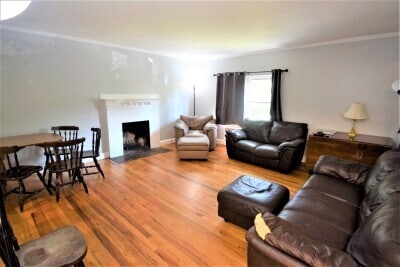
11-11 Undine Rd, Boston, MA 02135
11-11 Undine Rd, Boston, MA 02135
Url: http://offcampushousing.mcphs.edu/housing/property/11-11-undine-rd/03n5yp2
Phone Number: (617) 584-5885
Data provided by TravelTime
| Number of Bedrooms | Number of Bathrooms | Rent Range | Square Footage | Name of Floor Plan | Unit Number | Availability | Newly Added | View More Details |
|---|
The fees below are based on community-supplied data and may exclude additional fees and utilities.
| Tara Plaza | Walk: 32 min | Distance: 1.7 mi |
|---|---|---|
| Washington Street Plaza | Walk: 31 min | Distance: 1.6 mi |
| Marketplace Center | Walk: 32 min | Distance: 1.7 mi |
| Boston Support Center | Drive: 17 min | Distance: 8.2 mi |
|---|
| Boston College Station | Walk: 3 min | Distance: 0.2 mi |
|---|---|---|
| South Street Station | Walk: 12 min | Distance: 0.6 mi |
| Chestnut Hill Avenue Station | Walk: 17 min | Distance: 0.9 mi |
| Chiswick Road Station | Walk: 19 min | Distance: 1.0 mi |
| Cleveland Circle Station | Walk: 23 min | Distance: 1.2 mi |
| Newtonville | Walk: 50 min | Distance: 2.6 mi |
| Boston Landing | Walk: 39 min | Distance: 2.1 mi |
| Yawkey | Drive: 9 min | Distance: 4.2 mi |
| West Newton | Drive: 9 min | Distance: 4.5 mi |
| Waverley | Drive: 11 min | Distance: 4.9 mi |
| General Edward Lawrence Logan International | Drive: 20 min | Distance: 10.0 mi |
|---|
| Boston College, Brighton | Walk: 8 min | Distance: 0.4 mi |
|---|---|---|
| Boston College | Walk: 8 min | Distance: 0.4 mi |
| Boston University | Walk: 64 min | Distance: 3.3 mi |
| Harvard University | Walk: 69 min | Distance: 3.6 mi |
| Chestnut Hill Reservation | Walk: 20 min | Distance: 1.0 mi |
|---|---|---|
| Hammond Pond Reservation | Walk: 28 min | Distance: 1.5 mi |
| John Fitzgerald Kennedy National Historic Site | Walk: 51 min | Distance: 2.7 mi |
| Frederick Law Olmsted National Historic Site | Walk: 48 min | Distance: 2.5 mi |
| Coit Observatory | Walk: 64 min | Distance: 3.3 mi |